849
WTNT34 KNHC 121455
TCPAT4
BULLETIN
Tropical Storm Isaac Advisory Number 20
NWS National Hurricane Center Miami FL AL092018
1100 AM AST Wed Sep 12 2018
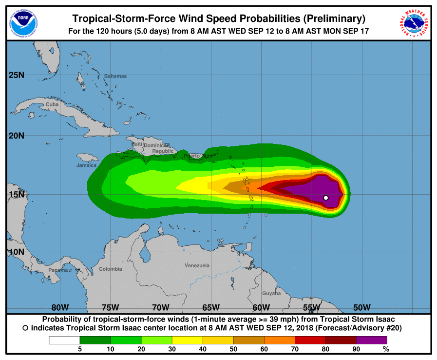
…ISAAC SHOULD REACH THE LESSER ANTILLES EARLY THURSDAY…
SUMMARY OF 1100 AM AST…1500 UTC…INFORMATION
———————————————–
LOCATION…15.0N 54.7W
ABOUT 420 MI…675 KM E OF MARTINIQUE
ABOUT 455 MI…730 KM E OF GUADELOUPE
MAXIMUM SUSTAINED WINDS…60 MPH…95 KM/H
PRESENT MOVEMENT…W OR 275 DEGREES AT 17 MPH…28 KM/H
MINIMUM CENTRAL PRESSURE…1000 MB…29.53 INCHES
WATCHES AND WARNINGS
——————–
CHANGES WITH THIS ADVISORY:
None.
SUMMARY OF WATCHES AND WARNINGS IN EFFECT:
A Tropical Storm Warning is in effect for…
* Martinique
* Dominica
* Guadeloupe
A Tropical Storm Watch is in effect for…
* Antigua
* Montserrat
* St. Kitts and Nevis
* Saba and St. Eustatius
A Tropical Storm Warning means that tropical storm conditions are
expected somewhere within the warning area within 24 to 36 hours.
A Tropical Storm Watch means that tropical storm conditions are
possible within the watch area, in this case within 24 to 36 hours.
Interests elsewhere in the Leeward Islands should monitor the
progress of Isaac.
For storm information specific to your area, please monitor products
issued by your national meteorological service.

DISCUSSION AND OUTLOOK
———————-
At 1100 AM AST (1500 UTC), the center of Tropical Storm Isaac was
located by a NOAA Hurricane Hunter aircraft near latitude 15.0
North, longitude 54.7 West. Isaac is moving toward the west near 17
mph (28 km/h), and this general motion with some decrease in forward
is expected to continue through the weekend. On the forecast track,
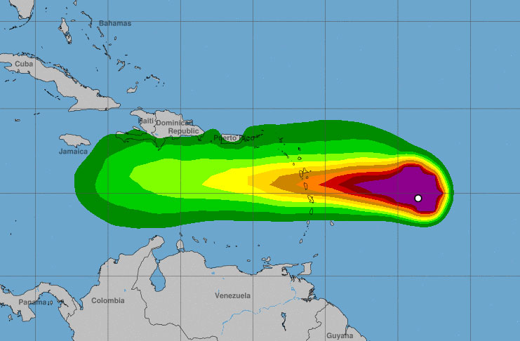
Isaac is forecast to move across the central Lesser Antilles and
into the eastern Caribbean Sea on Thursday, and then move across the
eastern and central Caribbean Sea through Saturday.
Aircraft data indicate that maximum sustained winds remain near 60
mph (95 km/h) with higher gusts. Gradual weakening is forecast
during the next 72 hours.
Tropical-storm-force winds extend outward up to 175 miles (280 km),
primarily to the north of the center.
The estimated minimum central pressure is 1000 mb (29.53 inches).
HAZARDS AFFECTING LAND
———————-
RAINFALL: Isaac is expected to produce total rainfall accumulations
of 2 to 4 inches with isolated amounts up 8 inches across
Martinique, Dominica, and Guadeloupe, 1 to 2 inches with isolated
amounts to 4 inches across Puerto Rico and the southern United
States Virgin Islands, with up to an inch anticipated across the
remaining Windward and Leeward Islands. This rainfall may cause
life-threatening flash flooding.
WIND: Tropical storm conditions are expected on Martinique,
Dominica, and Guadeloupe early Thursday. Tropical storm conditions
are possible within the tropical storm watch area on Thursday.
STORM SURGE: Some coastal flooding is possible in areas of onshore
winds. Near the coast, the surge will be accompanied by large
waves.
SURF: Swells generated by Isaac will begin to affect portions
of the Lesser Antilles this afternoon. These swells are likely to
cause life-threatening surf and rip current conditions. Please
consult products from your local weather office.
NEXT ADVISORY
————-
Next intermediate advisory at 200 PM AST.
Next complete advisory at 500 PM AST.
$$
Forecaster Blake


