626
WTNT34 KNHC 140236
TCPAT4
BULLETIN
Tropical Storm Isaac Advisory Number 26
NWS National Hurricane Center Miami FL AL092018
1100 PM AST Thu Sep 13 2018
…ISAAC MOVING WESTWARD ACROSS THE EASTERN CARIBBEAN SEA…
…BANDS OF RAIN LINGERING OVER THE LESSER ANTILLES…
SUMMARY OF 1100 PM AST…0300 UTC…INFORMATION
———————————————–
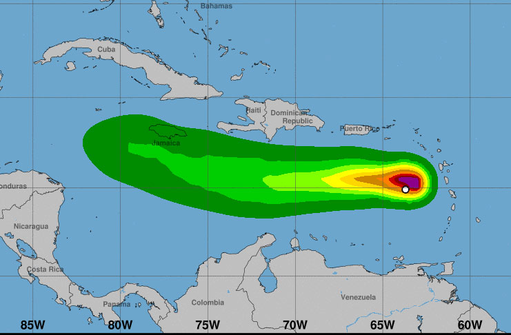
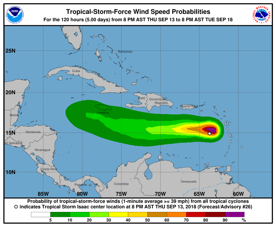
LOCATION…14.9N 64.4W
ABOUT 195 MI…315 KM S OF ST. CROIX
ABOUT 440 MI…710 KM SE OF SANTO DOMINGO DOMINICAN REPUBLIC
MAXIMUM SUSTAINED WINDS…40 MPH…65 KM/H
PRESENT MOVEMENT…W OR 270 DEGREES AT 16 MPH…26 KM/H
MINIMUM CENTRAL PRESSURE…1006 MB…29.71 INCHES
WATCHES AND WARNINGS
——————–
There are no coastal watches or warnings in effect.
DISCUSSION AND OUTLOOK
———————-
At 1100 PM AST (0300 UTC), the center of Tropical Storm Isaac was
located near latitude 14.9 North, longitude 64.4 West. Isaac is
moving toward the west near 16 mph (26 km/h), and this general
motion with a decrease in forward speed is expected for the next
few days. On the forecast track, Isaac will move over the eastern
and central Caribbean Sea during the next few days.
Maximum sustained winds are near 40 mph (65 km/h) with higher gusts.
Isaac is forecast to gradually weaken over the next few days, and
could degenerate into a tropical wave at any time.
Tropical-storm-force winds extend outward up to 105 miles (165 km)
from the center.
The estimated minimum central pressure is 1006 mb (29.71 inches).
HAZARDS AFFECTING LAND
———————-
RAINFALL: Isaac is expected to produce additional rainfall of 2 to
3 inches with isolated amounts up to 5 inches across the northern
Windward Islands into the Leeward islands, and southeastern Puerto
Rico. Totals of 1 to 2 inches with maximum amounts of 3 inches are
possible across the remainder of Puerto Rico, the Virgin Islands,
Dominican Republic and Haiti. This rainfall may cause
life-threatening flash flooding.
SURF: Swells generated by Isaac are still affecting portions of the
Lesser Antilles. These swells are likely to cause life-threatening
surf and rip current conditions. Please consult products from your
local weather office.
NEXT ADVISORY
————-
Next complete advisory at 500 AM AST.
$$
Forecaster Brown

