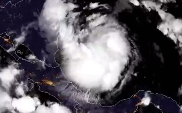
NEMO and the Met Service hereby inform the public that as at 4:30 p.m., local time Tropical Storm Nate with winds of 40 miles per hour was located near 14.9 North Latitude and 84.3 West Longitude or approximately 460 miles south east of Belize. The pressure was at 1001 milibars. Nate is moving to the north-northwest at 10 miles per hour. The main threat to Belize is expected to be mostly thunderstorms and heavy rain which are likely to cause dangerous flash floods and localized flooding. As much as 6 inches or higher rainfall is expected.
The current track keeps the centre of the storm in the warm waters off the coast of Belize. The stronger winds are expected to be east of Belize, over the sea. By tomorrow Nate is expected to be directly in front of Belize. It is likely that a Tropical Storm Watch will be issued. Nate is forecasted to reach the north-eastern Yucatan Peninsula and head into the Gulf of Mexico by Friday night or early Saturday. Due to the size of the system the country could continue to experience rainfall even after the storm gets into the Gulf of Mexico.
People in low-lying areas are advised to move to higher grounds. If you need to go to a shelter, know which shelter you will go to and workout how you will reach the shelter. Check up on family members and neighbors who are in need of assistance. Secure as much food and water as possible. At risk families, the elderly, women, and children are encouraged to weather the storm in a safe dry place. Do not wait until it’s too late to take action.
It is not advised to venture out to sea tomorrow. Fishers and people on the Cayes are hereby strongly urged to monitor Tropical Storm Nate and to take the necessary actions to preserve life and property. Farmers are urged to attend to their crops and animals. Crossings; in the Cayo district the Succotz Ferry is closed, and in the Stann Creek district, the Coastal road is closed due to flooding. The public is advised to stay out of flood waters.
Drivers are reminded to drive with extreme caution, when driving in wet conditions, reduce your speed, put on your low beam, and hazard lights. Do not drive through flood waters.
NEMO’s Emergency Coordinators can be reached as follows:
– Corozal, Mr. Williard Levy at 623 0237;
– Orange Walk, Ms. Suliema Celiz at 605 5046, or Mr. Aragon at 636 6094;
– Belize District, Mr. Lionel Tillett at 6154834 and Mr. Kevin Pollard at 621 2275;
– San Pedro, Ms. Vanessa Parham at 632 3698;
– Belize City, Ms. Timrose Augustine at 600 8672 and Councillor Willoughby at 615 9793;
– Belmopan, Ms. Clare Moody at 630 9791;
– Cayo, Mr. Al Westby at 630 3224 or Mr. Johnny Ramclam at 625 2526;
– Stann Creek, Mr. Keith Emmanuel at 615 9711; and
– Toledo, Mr. Kenton Parham at 630 9787.
– The NEMO Emergency Hotline is 936.
NEMO is on full alert and continues to monitor Tropical Storm Nate. Please take heed to the advice issued by NEMO and the National Meteorological Service.
More on Belize


