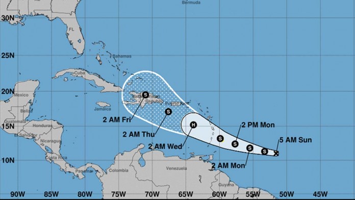
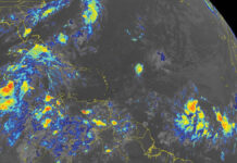
Tropical Storm Dorian Advisory #4
Summary of 500 AM AST…0900 UTC…Information
Location: 11.0N 51.6W
About 555 miles (890 km) ESE of Barbados
Maximum Sustained Winds: 40 MPH (5 km/h)
Present movement: W or 280 degrees at 13 MPH (20 km/h)
Minimum Central Pressure: 1008 mb…29.77 inches
WATCHES AND WARNINGS
CHANGES WITH THIS ADVISORY:
The government of Barbados has issued a Tropical Storm Watch for
Barbados.
SUMMARY OF WATCHES AND WARNINGS IN EFFECT:
A Tropical Storm Watch is in effect for…
- Barbados
A Tropical Storm Watch means that tropical storm conditions are
possible within the watch area, generally within 48 hours.
Additional watches will likely be issued later today for portions
of the Windward and Leeward Islands. Elsewhere, interests in Puerto
Rico and Hispaniola should monitor the progress of Dorian.
For storm information specific to your area, please monitor
products issued by your national meteorological service.
DISCUSSION AND OUTLOOK
At 500 AM AST (0900 UTC), the center of Tropical Storm Dorian was
located near latitude 11.0 North, longitude 51.6 West. Dorian is
moving toward the west near 13 mph (20 km/h), and this motion is
expected to continue today, followed by a motion toward the
west-northwest on Monday and Tuesday. On the forecast track,
Dorian is expected to be near the central Lesser Antilles late
Monday or early Tuesday.
Maximum sustained winds remain near 40 mph (65 km/h) with higher
gusts. Some strengthening is forecast during the next 48 hours,
and Dorian could be near hurricane strength over the eastern
Caribbean Sea.
Tropical-storm-force winds extend outward up to 25 miles (35 km)
from the center.
The estimated minimum central pressure is 1008 mb (29.77 inches).
HAZARDS AFFECTING LAND
RAINFALL: Dorian is expected to produce total rain accumulations of
2 to 4 inches in portions of the Lesser Antilles, with possible
isolated maximum amounts of 6 inches.
WIND: Tropical storm conditions are possible within the watch
area by late Monday.
SURF: Swells generated by Dorian will be affecting portions of the
Lesser Antilles by late Monday. These swells could cause life-
threatening surf and rip current conditions. Please consult
products from your local weather office.


