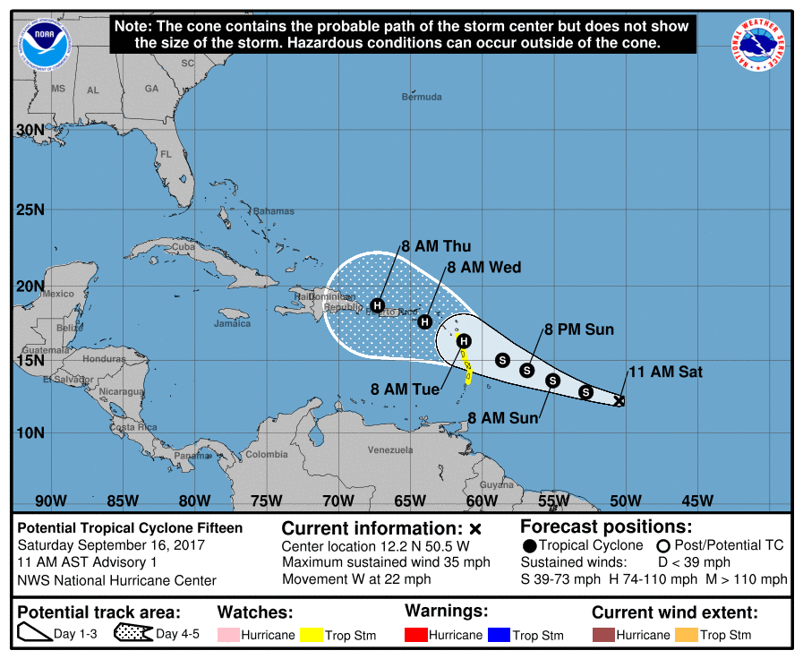
Tropical storm watches have been issued for St Lucia, Martinique, Guadeloupe and Dominica.
Interests elsewhere in the Lesser Antilles have been told to monitor the progress of a potential tropical cyclone located 755 miles east-southeast of the Lesser Antilles.
Additional tropical storm or hurricane watches will likely be issued later today.
At 11 a.m. the disturbance was centred near latitude 12.2 North, longitude 50.5 West. The system is moving toward the west near 22 mph (35 km/h). A slower west-northwest motion is expected during the next couple of days. On the forecast track, the system is expected to approach the Leeward Islands on Monday.
Maximum sustained winds are near 35 mph (55 km/h) with higher gusts. Strengthening is expected during the next 48 hours. The disturbance is forecast to become a tropical storm later today and could be near hurricane strength when it approaches the Leeward Islands.
Satellite images indicate that the disturbance has become better organized, and it is expected to become a tropical cyclone later today or tonight.
More: https://cpressrelease.com/tropical-weather-outlook-200-edt-fri-sep-15-2017/


